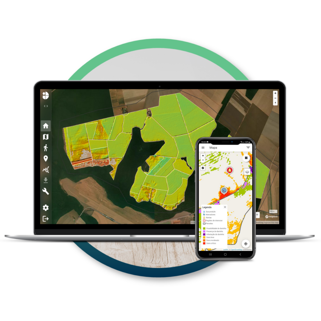
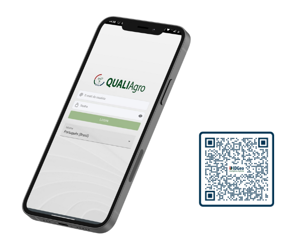
Combining our experience with the most advanced in terms of technology, we turn concrete data into simple and powerful information, so that you can constantly monitor your crop and make assertive decisions.
We are pioneers in agricultural intelligence and geotechnology
Our team was formed from the area of research and development, which allowed us to pioneer applications of geotechnology in agriculture from the beginning, constantly improving our algorithm and expanding our horizons.
We have a multidisciplinary and specialized team
More than technology, IDGeo is made up of people. Each one who is now part of the team brings with them a history, an experience and a specialization. It is this multidisciplinary set that allows innovation to happen first within IDGeo, so that it can be taken out later.
State-of-the-art technologies integrated with field knowledge
The cutting-edge technologies offered by IDGeo would not be the same if they had not been developed based on exchanges with our customers. Adding each of them to the knowledge of the field is what makes them so powerful.
We offer continuous monitoring of your crop
Combining our experience with the most advanced in terms of technology, we turn concrete data into simple and powerful information, so that you can constantly monitor your crop and make assertive decisions.
We are pioneers in agricultural intelligence and geotechnology
Our team was formed from the area of research and development, which allowed us to pioneer applications of geotechnology in agriculture from the beginning, constantly improving our algorithm and expanding our horizons.
We have a multidisciplinary and specialized team
More than technology, IDGeo is made up of people. Each one who is now part of the team brings with them a history, an experience and a specialization. It is this multidisciplinary set that allows innovation to happen first within IDGeo, so that it can be taken out later.
State-of-the-art technologies integrated with field knowledge
The cutting-edge technologies offered by IDGeo would not be the same if they had not been developed based on exchanges with our customers. Adding each of them to the knowledge of the field is what makes them so powerful.
Solutions that make a difference in your decision making
We make data accessible and transform it into simple information to increase the sustainability and profitability of your business
A real view of your cultivation that goes beyond the clouds
A major challenge for those who work with satellite images is the occurrence of clouds, as they prevent the data of the object being studied from being captured.
Therefore, the radar appears as an alternative to overcome this challenge, in addition to bringing other advantages
Satellites
Conventional
They are passive orbital sensors, that is, the energy source is the Sun.
Depends on weather conditions
Day-only image capture
Restricts its reach to the tops of plants
Radars
They are active orbital sensors and emit their own energy source
Greater independence from weather conditions
Day and night image capture
Greater penetration of waves into targets (operates in the microwave range)
Conventional non-continuous images
05/03/2022
10/03/2022
15/03/2022
20/03/2022
25/03/2022
30/03/2022
IDGeo images
Field monitoring even in the presence of clouds
05/03/2022
10/03/2022
Have your production data in the palm of your hand
The management of your agricultural production can accompany you anywhere, anytime
Our integration lets you know everything
Discover the benefits of having all your production intelligence in one place
We plant efficiency, our customers reap satisfaction
Check out some testimonials from our customers about IDGeo
EstebanCia. Azucarera Los Balcanes – Argentina
Through IDGeo's solution, we can see the performance of the sugarcane field throughout its cycle and monitor the anomalies found in the field. It is an excellent tool to assist in large-scale management.
LeonardoBracell
IDGeo is proving to be a great partner in the development of a functional technology for the forestry area. Engaged team, which seeks to understand the client's difficulties and propose solutions in a technical way, with an operational and management vision.
VictorAgrodan
Currently, our partnership has been very beneficial in the evolution of the humidity mapping system within the farms, consisting in the joint creation of a management panel that will serve as a tool for identifying regions outside the ideal humidity range. The project is of interest to Agrodan both for its ability to summarize and detail important information for assertive action.
SandroUsina Santo Antônio
The IDGeo course was very important for us and we will be able to automate our map production.
Jobim Usina Vista Alegre
I was very happy to participate in the IDGeo course, because now I will implement the thematic maps in my service and improve the production processes that I need to do in my daily life.
Tiago Raízen – Barra Bonita
Realmente me gustó IDGeo, porque ahora comenzamos a implementar QGIS en la planta y hace todo lo que necesitamos, además del mapeo gratuito. Ahora, además de la técnica, tengo una carga teórica sobre lo que hacía. Muy fresco y productivo. La automatización de mapas también, ya que es algo que toda planta debe saber.
FernandoUsina Cocal
We are going to use IDGeo's knowledge a lot in our agricultural planning to always have the maps we need, registers and data at hand. Now we will also have a new distribution of schedules for the application of pesticides, among other benefits.
Key Clients
Get to know the companies that are shaping the agribusiness with us
Optimize your production with hard data for accurate decisions
Talk to one of our experts and learn more